Layers — Settings for each layer
Principle
To set parameters for each layer in the project, which are related to the server or the behavior in Lizmap Web Client.
Configuring the tool
The layer configuration is done in the Layers tab.
This tab shows the layers tree of the project with the same organization that is defined in the Layers panel. You can select one of the tree elements, a layer or group, and then configure the options for the selected group or layer.
Information about groups and layers:
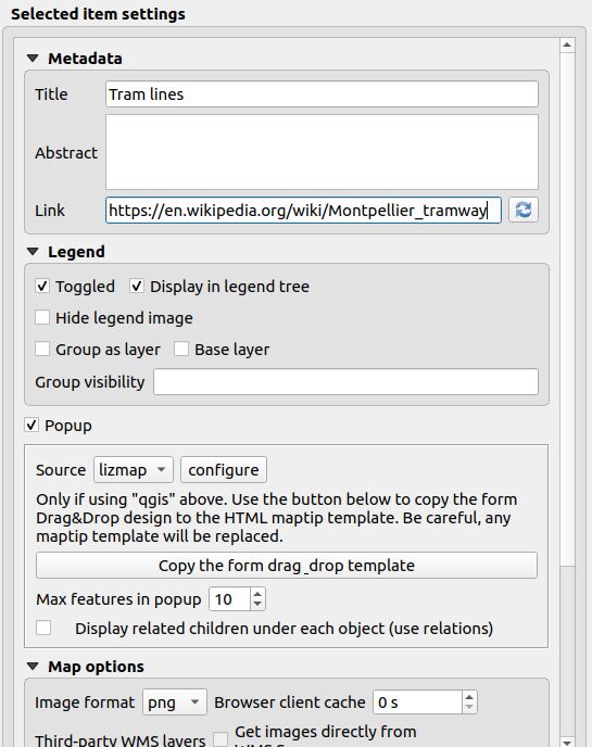
Title: It will be used in the Web layers tree instead of the name. For layers, the Title field is linked to that of the QGIS Server tab in the layer properties window
Abstract: It allows to describe the layer or group. It is displayed in the mouseover. For layers, the Abstract Field is linked to that of the QGIS Server tab in the layer properties window
Link: The URL of a document or a web page describing the layer or group.
An icon
 appears in the Lizmap legend if the link has been set. You can use the Media folder to build an internal link.
The button
appears in the Lizmap legend if the link has been set. You can use the Media folder to build an internal link.
The button  will pick the value set in the .
Layers options:
Toggled: allows you to specify whether a layer is displayed by default
Display in legend tree: toggles visibility of the layer in the layers tree; when toggled off, it does not allow the user to manage the display of it
Hide legend image: allows you to hide the legend of the layer in the web interface
Group as layer: Option to use on a group in the legend to display it as a single layer, read below
Base layer: sets the layer as a base map. This will be accessible via the list of basemap
Activate popup: enables information popups on map’s interrogation by clicking. See Popup
Single Tile: selects the layer display mode. It can be displayed as multiple images, tiles, or a single image generated by the server
Image format:
png: full image format, full range of colors with transparencypng; mode=16bit: lighter image format, panel color restricted with transparencypng; mode=8bit: very light image format, color panel restricts to the maximum with transparency, possible degradation of the imagejpeg: light image format without transparency with loss of quality
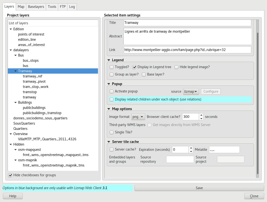
If the layer is provided by a WMS service and that it supports the Web map Coordinate Reference System, it is possible to Directly Request images to the WMS server. This reduces the QGIS-Server load and optimize Lizmap. This option is available in the Third Party WMS layers group.
The group options:
Group as layer:
transforms a group in a single layer in the web interface
used to group layers with scale dependent visibility
simplifies the interface to the users of the Web map
to create a base map from multiple layers
if the group is a layer other options apply to it.
Server tile cache