Base layers — Layers used for the background of the map
Principle
It is often useful to separate base layers as a reference and thematic layers in a Web map. In Lizmap, you can use groups or layers as base layers. It is also possible to use external services in the Web map.
The base layers are not part of the legend and are presented as a list.
Note
If a single base layer is configured (project layer, external service or empty base layer), then Lizmap Web Client interface does not show the box Base layers, but the layer will be however visible below the other layers.
Configuring the tool
The Base layers tab lets you add external services as base layer and an empty base layer. The empty base layer will display thematic layers over the project background color.
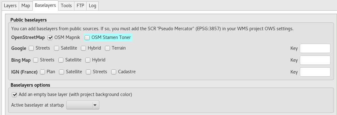
The available base layers
OpenStreetMap, mapping project under free and open licenses:
OSM Mapnik: service available on openstreetmap.org
OSM stamen toner
OpenTopoMap
ThunderForest, API key required: * Open Cycle Map: OpenStreetMap cycling data including altitude information
Google, API key required:
Streets: the default Google Maps background layer
Satellite: the background map incorporating aerial and satellite images
Hybrid: the background map mixing streets and satellite
Terrain
Bing Map, API key required:
Streets: the default Bing Map background layer
Satellite: the background map incorporating aerial and satellite images
Hybrid: the background map mixing streets and satellite
IGN Géoportail, API key required for one layer:
Plan: The IGN rendering for the Web
Satellite: the background map incorporating IGN aerial and satellite images
Scan: the background map mixing the various IGN scan, API key needed
Cadastre
The licenses are available at the following URLs:
Scale with external base layer
All these external base layer are provided only in EPSG:3857 / Pseudo Mercator from the provider. The scale of such layer are fixed by the projection EPSG:3857.
Warning
As a result, if you choose an external base layer, the project will be displayed in Google Mercator EPSG:3857. Therefore, if you have specified multiple scales in the Lizmap configuration, these intermediate scales won’t be used. Only the minimum and maximum scale are used in this case. Read below about approximate scales.
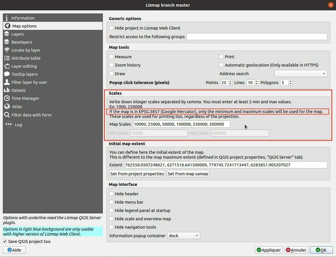
QGIS Server will perform on the fly reprojection for your data. It is therefore necessary to prepare the QGIS project accordingly.
The Google Mercator coordinate reference system must be added in the Web Services CRSs list with the .
This is a list of a very approximate integer scale for a given zoom level for the EPSG:3857:
0   500 000 000
1   250 000 000
2   150 000 000
3   70 000 000
4   35 000 000
5   15 000 000
6   10 000 000
7   4 000 000
8   2 000 000
9   1 000 000
10  500 000
11  250 000
12  150 000
13  70 000
14  35 000
15  15 000
16  8 000
17  4 000
18  2 000
19  1 000
20  500
Warning
These scales are just a hint of the scale. It is not possible to have rounded scale like this with EPSG:3857.
Visit the OpenStreetMap website at the country level and check how the scale is changing while panning/zooming.
External Lizmap layers
This feature has been removed. It’s replaced by the possibility of using the menu , and in the plugin Layers tab declare the parent project and the Lizmap repository for the embed layers and groups. See Centralizing the cache with the integration of groups and layers from a master project