Prepare o projeto QGIS para a Web
Crie o seu projeto
Adicione os seus dados
Ficheiros de dados geográficos vetoriais
ESRI Shapefile
MapInfo TAB e MIF/MID
GeoJSON
etc
Ficheiros RASTER de dados geográficos
GeoTIFF
Arc/Info ASCII Grid
netCDF
etc
Base de dados geográficos
PostgreSQL / PostGIS
When you create your connection to PostGIS, use the checkbox Use estimated metadata. Be careful, changing this checkbox after you have already added a layer doesn’t change layers already loaded.
MSSQL espacial
Oracle locator / spatial
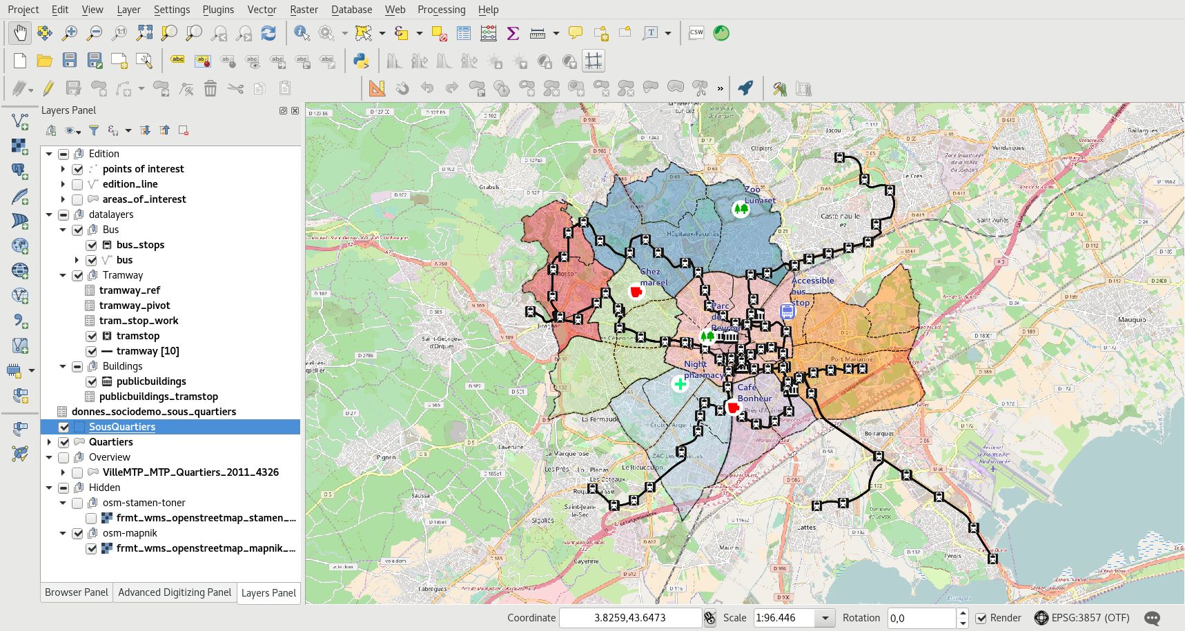
Organize and manipulate the layers in the legend:
Adicionar grupos com um clique direito na parte vazia da legenda: Adicionar um novo grupo
Mover camadas e grupos com arrastar e soltar
Rename layers and groups with the F2 or the layer properties window
Manipular a ordem de renderização
com a ordem das camadas na legenda: as camadas superiores são renderizadas acima das outras.
by specifying layer order with the menu
Adicione um título ao seu projeto e grave-o no seu diretório de trabalho.
Nota
If your layer has more than one style, the user will be able to switch between them through the button Change layer style at the top of the legend.
Configure seu projeto para a Web
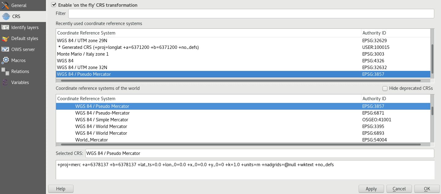
Configure o sistema de referência de coordenadas, CRS, do seu projeto:
Selecione o CRS do seu mapa Web:
EPSG:3857 para o Google Mercator
EPSG:2154 para o Lambert 93
etc
QGIS can reproject raster and vector data.
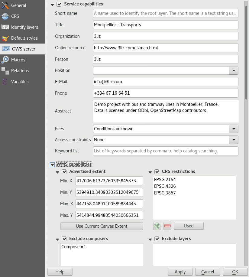
Configure the Web Geographics Services parameters with the QGIS Server tab:
Set the title of your Web Geographics Services. This title is used in the Lizmap landing page.
Adicione informações como sua organização, o proprietário da publicação, o resumo, etc.
Definir a extensão máxima do seu serviço WMS
Restringir a lista de CRSs do seu serviço WMS:
pelo menos, selecione aquele utilizado no seu projeto
pode utilizar o botão Usar para obter todos os CRS da camada para esse projeto
Excluir compositores e camadas se os dados não puderem ser publicados via WMS
Ativar as camadas que deseja publicar via WFS e WCS
Check that the paths are saved relative in the general tab of the project properties window, access it with the menu or CTRL+SHIFT+P.
Configurar as suas camadas Web
In the window allows you to configure a lot of information for Web Geographic Services:
Fornecer um título, uma descrição e palavras-chave
Especificar a obrigação de respeitar a licença de dados
Adicionar o URL do registo de metadados se estiver disponível
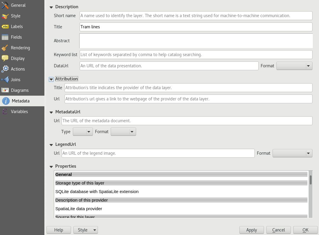
In the window Rendering tab, enable the Simplify geometry and the Simplify on the provider side if possible checkbox too. Note this can be changed in your global settings for layers added later. Read Server side simplification.
Save your QGIS project
Aviso
In QGIS 3, it’s possible to save your project in QGZ format or in database (PostGIS/Geopackage).
Lizmap does not support these formats.
You must save your project as QGS extension by doing and not choosing QGZ.
You should save your project as QGS file on your filesystem before opening the Lizmap plugin in the next step.