Map options
The tab Map options allows you to enable or disable basic Lizmap tools, choosing scales and the initial extent.
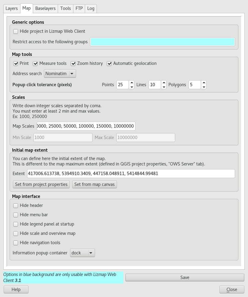
Generic options
hide the project in Lizmap Web Client:
if this option is checked, the project will be hidden in the Lizmap home page that shows thumbnails for all directories and project of the application. You can use this option to hide the project
the project will still be accessible for WMS or WFS clients based on directories rights
this feature is interesting in the case of using this project as an external project for other ones.
Map tools
Draw: enables some drawing tools.
Print: enables the use of QGIS compositions for PDF generation map
Measure tools: enables the measurement tools in the map (length, area, perimeter)
Zoom history: enables the navigation buttons in the history of zoom and move in the map
Automatic geolocation: enables the functions to use the HTML5 geolocation based on Wifi and/or GPS
Address search: to add an address search engine that is based on one of these services:
Nominatim (OpenStreetMap)
Google (API key required, see Base layers)
IGN France (Géoportail)
BAN (France)
Scales
a list of integer values separated by commas (and optional whitespace), eg:
250000, 100000, 50000.Lizmap also used these scales to restrict the application display between the minimum and maximum of these scales. This is why it is mandatory to enter at least 2 scales in the list.
Warning
As soon as there is an external basemap published in EPSG:3857 such as OSM, Google Maps…, the application will only use the minimum and maximum scale to the minimum and maximum zoom level. Intermediate scale that you might have defined won’t be read, because there isn’t a strict match between your scale and zoom level provided by external base map in EPSG:3857.
Initial map extent
a list of coordinates in the Reference Coordinate System map in the format:
xmin, ymin, xmax, ymax, setting the initial map extentthe maximal map extent is specified in the QGIS server tab of Project Properties window. The data will not be displayed if they are outside it
by default, the initial extent is the maximal one.
Map interface
To hide by default some components in the user interface.