Set up your project for Lizmap
Install the Lizmap plugin
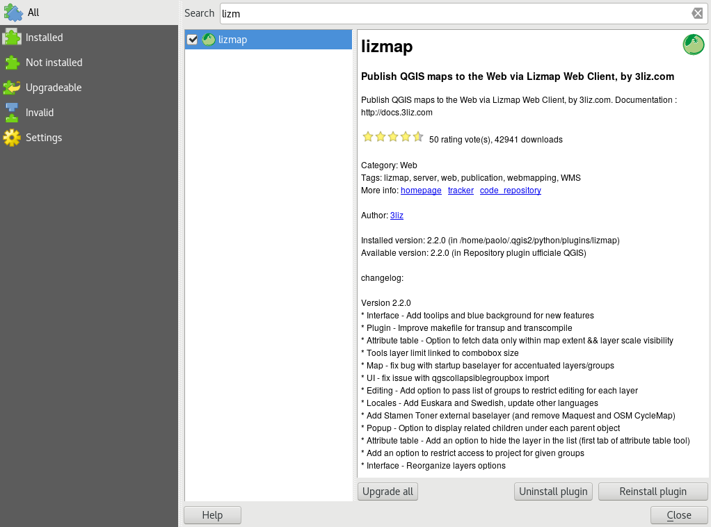
The Lizmap plugin is available through the official QGIS project repository: http://plugins.qgis.org/plugins/lizmap/
To install it, just do it like any QGIS plugin:
Search Lizmap
Install the plugin
It’s available in the menu and toolbar
The plugin is organized in 6 tabs:
Layers: the options of each layer
Map: the general options of the map
Baselayers: the baselayers used on the Web
Tools : the Web map tools
FTP: The configuration for synchronization through the plugin
Log: displays information of performed actions
And it has 4 action buttons:
Help
Save
Save and synchronize
Close
Configure layers and groups
The layer configuration is done in the Layers tab.
This tab shows the layers tree of the project with the same organization that is defined in the Layers panel. You can select one of the tree elements, a layer or group, and then configure the options for the selected group or layer.
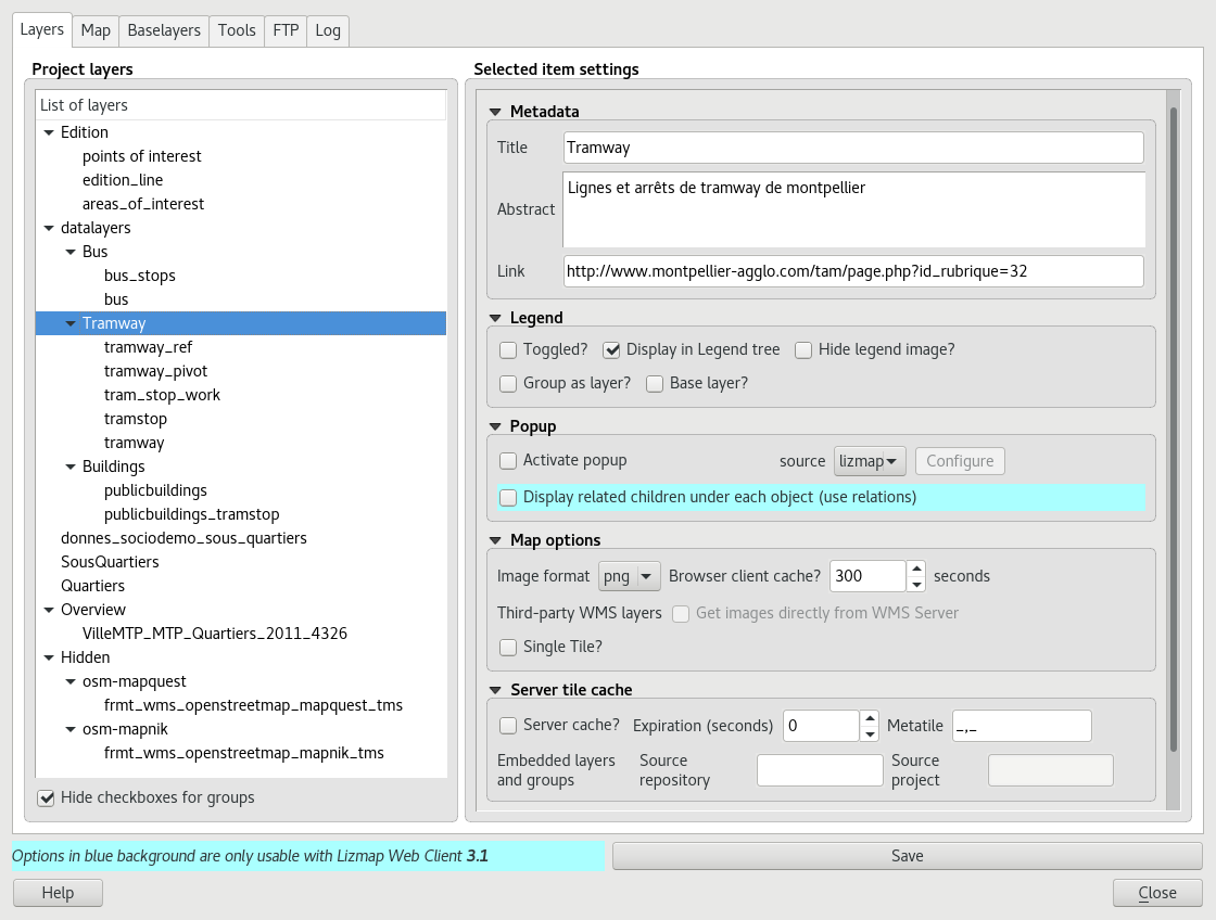
Information about groups and layers:
Title: It will be used in the Web layers tree instead of the name. For layers, the Title Field is linked to that of the Metadata tab in the layer properties window
Abstract: It allows to describe the layer or group. It is displayed in the mouseover. For layers, the Abstract Field is linked to that of the Metadata tab in the layer properties window
Link: The web address of a document or a Web page describing the layer or group. An icon (i) appears in the legend if the link has been submitted. You can use the media folder, see Media in Lizmap.
Layers options:
Toggled: allows you to specify whether a layer is displayed by default
Activate popup: enables information popups on map’s interrogation by clicking. See How to configure popups
Hide legend image: allows you to hide the legend of the layer in the web interface
Display in legend tree: toggles visibility of the layer in the layers tree; when toggled off, it does not allow the user to manage the display of it
Base layer: sets the layer as a base map. This will be accessible via the list of basemap
Single Tile: selects the layer display mode. It can be displayed as multiple images, tiles, or a single image generated by the server
Image format:
png: full image format, full range of colors with transparency
png; mode=16bit: lighter image format, panel color restricted with transparency
png; mode=8bit: very light image format, color panel restricts to the maximum with transparency, possible degradation of the image
jpeg: light image format without transparency with loss of quality
If the layer is provided by a WMS service and that it supports the Web map Coordinate Reference System, it is possible to Directly Request images to the WMS server. This reduces the QGIS-Server load and optimize Lizmap. This option is available in the Third Party WMS layers group.
The group options:
Group as layer:
transforms a group in a single layer in the web interface
used to group layers with scale dependent visibility
simplifies the interface to the users of the Web map
to create a base map from multiple layers
if the group is a layer other options apply to it.
Configure the map
The tab Map allows you to enable or disable basic Lizmap tools, choosing scales and the intial extent.
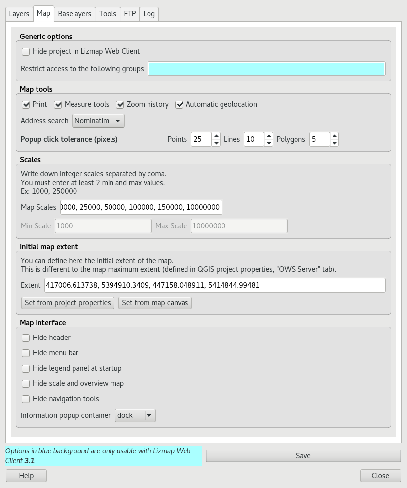
The generic options:
hide the project in Lizmap Web Client:
if this option is checked, the project will be hidden in the Lizmap home page that shows thumbnails for all directories and project of the application. You can use this option to hide the project
the project will still be accessible for WMS or WFS clients based on directories rights
this feature is interesting in the case of using this project as an external project for other ones.
The map tools:
Print: enables the use of QGIS compositions for PDF generation map
Measure tools: enables the measurement tools in the map (length, area, perimeter)
Zoom history: enables the navigation buttons in the history of zoom and move in the map
Automatic geolocation: enables the functions to use the HTML5 geolocation based on Wifi and/or GPS
Address search: to add an address search engine that is based on one of these services:
Nominatim (OpenStreetMap)
Google
IGN France (Géoportail)
The scales :
a list of integer values separated by commas (and optional whitespace), eg: 250000, 100000, 50000.
Lizmap also used these scales to restrict the display between the minimum and maximum data scales. This is why it is mandatory to enter at least 2 scales in the list.
The initial map extent:
a list of coordinates in the Reference Coordinate System map in the format:
xmin, ymin, xmax, ymax, setting the initial map extentthe maximal map extent is specified in the OWS server tab of Project Properties window. The data will not be displayed if they are outside it
by default, the initial extent is the maximal one.
Configure the base layers
It is often useful to separate base layers as a reference and thematic layers in a Web map. In Lizmap, you can use groups or layers as base layers. It is also possible to use external services in the Web map.
The base layers are not part of the legend and are presented as a list.
Note
If a single base layer is configured (project layer, external service or empty base layer), then Lizmap Web Client interface does not show the box Base layers, but the layer will be however visible below the other layers.
The Base layers tab lets you add external services as base layer and an empty base layer. The empty base layer will display thematic layers over the project background color.
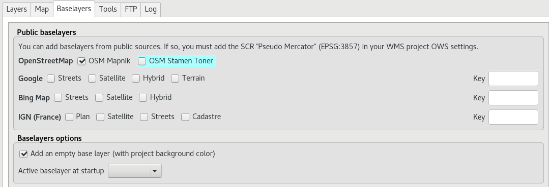
The available base layers
OpenStreetMap, mapping project under free and open licenses:
OSM Mapnik: service available on openstreetmap.org
OSM Mapquest: service provided by Mapquest company
Cycle Map: promotion map of OpenStreetMap cycling data including altitude information
Google, requires compliance to use licence agreement:
Streets: the default Google Maps background layer
Satellite: the background map incorporating aerial and satellite images
Hybrid: the background map mixing streets and satellite
Terrain
Bing Map, requires compliance with the Microsoft license agreement and therefore a key:
Streets: the default Bing Map background layer
Satellite: the background map incorporating aerial and satellite images
Hybrid: the background map mixing streets and satellite
IGN Géoportail, requires compliance with the IGN license agreement and therefore a key:
Plan: The IGN rendering for the Web
Satellite: the background map incorporating IGN aerial and satellite images
Scan: the background map mixing the various IGN scan
The licenses are available at the following URLs:
OpenStreetMap: http://wiki.openstreetmap.org/wiki/Tile_usage_policy
Mapquest: http://developer.mapquest.com/web/products/open/map#terms
Note
If you choose an external base layer, the map will be displayed in Google Mercator (EPSG: 3857 or EPSG: 900913), the scales are those of external services and QGIS-Server will perform on the fly reprojection.
It is therefore necessary to prepare the QGIS project accordingly.
The Google Mercator coordinate reference system must be added in the Web Services CRSs list with the OWS Server tab in the Project Properties window. For now, all the proposed base layers use the projection:
EPSG:3857 ; Pseudo Mercator
Here are the approximate integer scales of the current external base layers:
0   591659008
1   295829504
2   147914752
3   73957376
4   36978688
5   18489344
6   9244672
7   4622336
8   2311168
9   1155584
10  577792
11  288896
12  144448
13  72224
14  36112
15  18056
16  9028
17  4514
18  2257
External Lizmap layers
This feature has been removed. It’s replaced by the possibility of using the menu , and in the plugin Layers tab declare the parent project and the Lizmap repository for the embed layers and groups. See Centralizing the cache with the integration of groups and layers from a master project