印刷
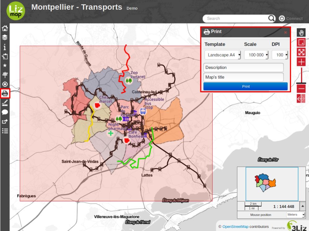
印刷機能は、Lizmapのメニューバーにあります。地図の公開者が公開しているプリントコンポジションの数に依存します。
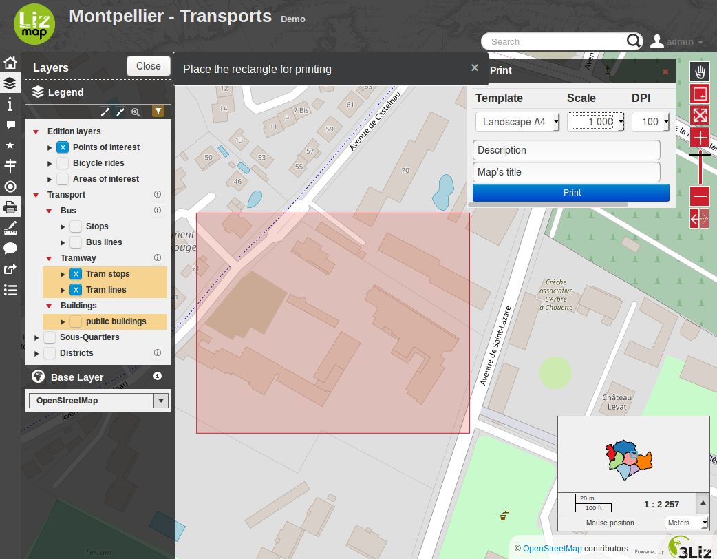
この機能が有効になると、コンポジションの形をした印刷エリアが地図上に表示されます。このエリアを使って、印刷する範囲を定義します。エリアを移動することもできます。
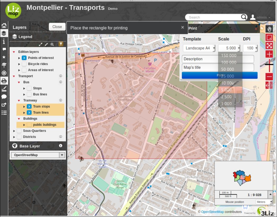
左側の、レイヤ管理パネルの上で、印刷する際の縮尺を選択することができます。
印刷の構成によっては、独自のテキストの入力が求められることもあります。
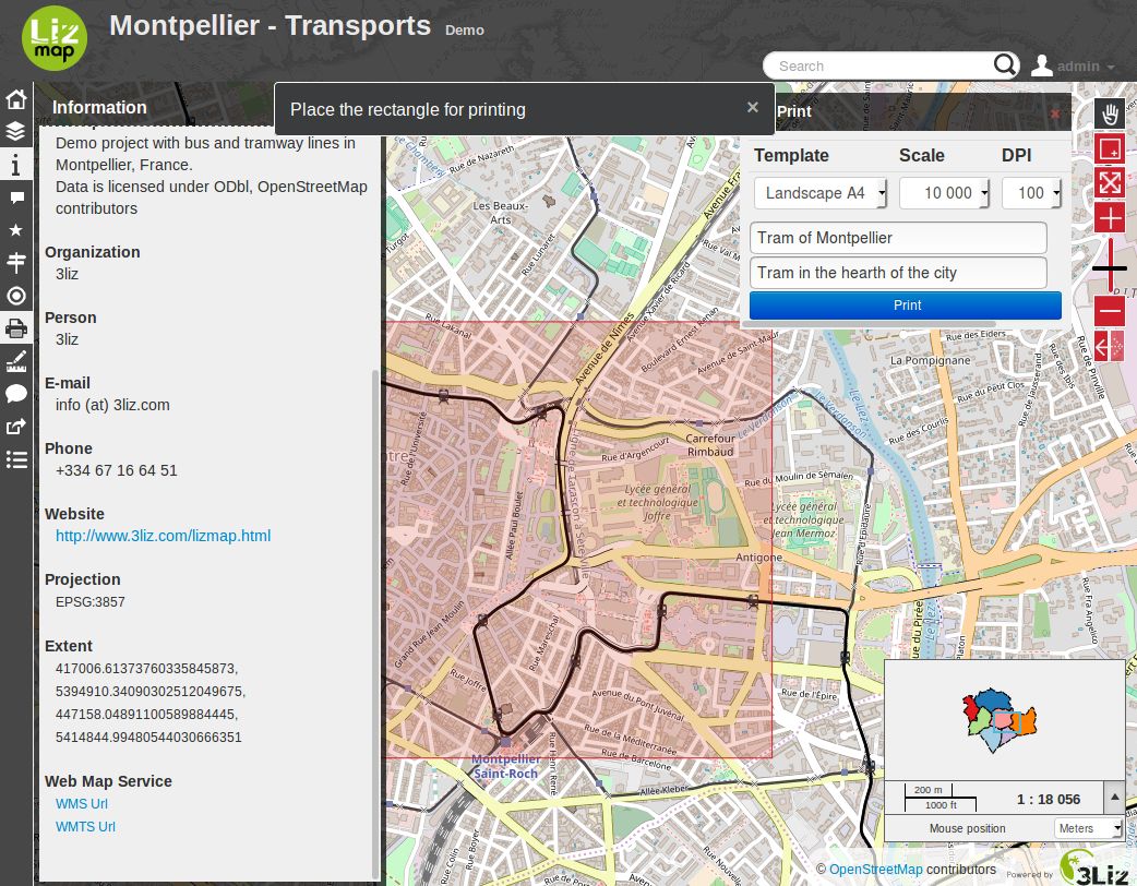
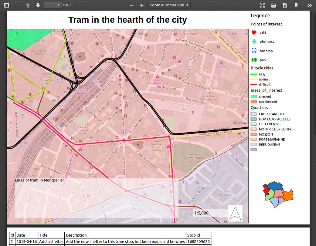
印刷するファイルの作成を開始するには、*印刷*をクリックします。地図の公開者によって定義されたレイアウトのPDFファイルが取得できます。