Action in a popup
This is a feature in Lizmap 3.4.
Principle
This module allows to add one or several action buttons in the Lizmap popup displayed for a PostgreSQL object, which will trigger a query in the database and return a geometry to display on the map.
It reads a JSON configuration file which must be placed aside the QGIS project in the same directory. This file lists the PostgreSQL actions to be added in the popup for one or many QGIS PostgreSQL vector layers.
Configuring the tool
Each action is characterized by a
layer id, aname, atitle, anicon, some optionaloptions,styleandcallbacks. A newconfirmproperty can be used since Lizmap 3.5A layer can have one or several actions
You can have one or several layers with their own actions
Example of this JSON configuration file, name myproject.qgs.action if the QGIS project file is named myproject.qgs.
In this project, there is a vector layer called Points with the internal layer ID points_a7e8943b_7138_4788_a775_f94cbd0ad8b6
(you can get the QGIS layer internal ID with the expression @layer_id)
{
    "points_a7e8943b_7138_4788_a775_f94cbd0ad8b6": [
        {
            "name": "buffer_500",
            "title": "Buffer 500m around this object",
            "confirm": "Do you really want to show the buffer ?",
            "icon": "icon-leaf",
            "options": {
                "buffer_size": 500,
                "other_param": "yes"
            },
            "style": {
                "graphicName": "circle",
                "pointRadius": 6,
                "fill": true,
                "fillColor": "lightblue",
                "fillOpacity": 0.3,
                "stroke": true,
                "strokeWidth": 4,
                "strokeColor": "blue",
                "strokeOpacity": 0.8
            },
            "callbacks": [
                {"method": "zoom"},
                {"method": "select", "layerId": "bati_1a016229_287a_4b5e_a4f7_a2080333f440"},
                {"method": "redraw", "layerId": "bati_1a016229_287a_4b5e_a4f7_a2080333f440"}
            ]
        }
    ]
}
The JSON configuration file lists the QGIS layers for which you want to declare actions.
Each layer is defined by its QGIS layer ID, for example here points_a7e8943b_7138_4788_a775_f94cbd0ad8b6,
and for each ID, a list of objects describing the actions to allow.
Each action is an object defined by:
a
namewhich is the action identifier.a
titlewhich is used as a label in Lizmap interfacean
iconwhich is displayed on the action button ( See https://getbootstrap.com/2.3.2/base-css.html#icons )an optional
confirmproperty, since Lizmap 3.5, containing some text. If set, a confirmation dialog will be shown to the user to ask if the action should really be launched or not. Use it if the action can modify some data in your database.an
optionsobject, giving some additional parameters for this action. You can add any needed parameter.a
styleobject allowing to configure the returned geometry style. It follows OpenLayers styling attributes.a
callbacksobject allows to trigger some actions after the generated geometry is returned. They are defined by amethodname, which can at present be:zoom: zoom to the returned geometryselect: select the features from a given layer intersecting the returned geometry. The target layer QGIS internal ID must be added in thelayerIdproperty. In the example, the features of the layer containing buildings, IDbati_1a016229_287a_4b5e_a4f7_a2080333f440will be selectedredraw: redraw (refresh) a given layer in the map. The target layer QGIS ID must be added in thelayerIdproperty.
Lizmap detects the presence of this configuration file, and adds the needed logic when the map loads. When the users clicks on an object of one of this layer in the map, the popup panel shows the feature data. At the top of each popup item, a toolbar will show one button per each layer action.
The action title will be displayed on hovering the action button.
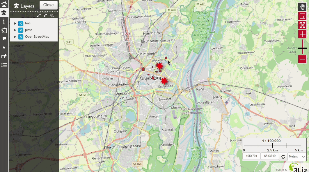
Each button triggers the corresponding action, if it is not yet active (else it deactivates and erases the geometry):
Lizmap backend checks if the action is well configured,
creates the PostgreSQL query and execute it in the layer PostgreSQL database. (See example below)
This query returns a GeoJSON which is then displayed on the map.
If some callbacks have been configured, they are launched
Since Lizmap 3.5, A Lizmap event
actionResultReceivedis emitted with the returned data and action properties.
The created PostgreSQL query is built up by Lizmap web client and
uses the PostgreSQL function lizmap_get_data(json)
which must be created beforehand in the PostgreSQL table database.
This function also uses a more generic function query_to_geojson(text)
which transforms any PostgreSQL query string into a GeoJSON output.
Here is an example below of the query executed in the PostgreSQL database by Lizmap Web Client internally,
for the example configuration given above, when the users clicks on the button action buffer_500,
for the feature with id 1 of the layer Points corresponding to the PostgreSQL table test.points:
SELECT public.lizmap_get_data('{
    "layer_name":"points",
    "layer_schema":"test",
    "layer_table":"points",
    "feature_id":1,
    "action_name":"buffer_500",
    "buffer_size":500,
    "other_param": "yes"
}') AS data;
You can see that Lizmap creates a JSON parameters with all needed information and run the PostgreSQL function lizmap_get_data(text).
You need to create this PostgreSQL function lizmap_get_data(text) which returns a valid GeoJSON text
with one single object in it.
The following SQL code is an example to help you create the needed functions.
Obviously, you must adapt it to fit your needs.
-- Returns a valid GeoJSON from any query
CREATE OR REPLACE FUNCTION query_to_geojson(datasource text)
RETURNS json AS
$$
DECLARE
    sqltext text;
    ajson json;
BEGIN
    sqltext:= format('
        SELECT jsonb_build_object(
            ''type'',  ''FeatureCollection'',
            ''features'', jsonb_agg(features.feature)
        )::json
        FROM (
          SELECT jsonb_build_object(
            ''type'',       ''Feature'',
            ''id'',         id,
            ''geometry'',   ST_AsGeoJSON(ST_Transform(geom, 4326))::jsonb,
            ''properties'', to_jsonb(inputs) - ''geom''
          ) AS feature
          FROM (
              SELECT * FROM (%s) foo
          ) AS inputs
        ) AS features
    ', datasource);
    RAISE NOTICE 'SQL = %s', sqltext;
    EXECUTE sqltext INTO ajson;
    RETURN ajson;
END;
$$
LANGUAGE 'plpgsql'
IMMUTABLE STRICT;

COMMENT ON FUNCTION query_to_geojson(text) IS 'Generate a valid GEOJSON from a given SQL text query.';

-- Create a query depending on the action, layer and feature and returns a GeoJSON.
CREATE OR REPLACE FUNCTION lizmap_get_data(parameters json)
RETURNS json AS
$$
DECLARE
    feature_id integer;
    layer_name text;
    layer_table text;
    layer_schema text;
    action_name text;
    sqltext text;
    datasource text;
    ajson json;
BEGIN

    action_name:= parameters->>'action_name';
    feature_id:= (parameters->>'feature_id')::integer;
    layer_name:= parameters->>'layer_name';
    layer_schema:= parameters->>'layer_schema';
    layer_table:= parameters->>'layer_table';

    -- Action buffer_500
    -- Written here as an example
    -- Performs a buffer on the geometry
    IF action_name = 'buffer_500' THEN
        datasource:= format('
            SELECT
            %1$s AS id,
            ''The buffer '' || %4$s || ''m has been displayed in the map'' AS message,
            ST_Buffer(geom, %4$s) AS geom
            FROM "%2$s"."%3$s"
            WHERE id = %1$s
        ',
        feature_id,
        layer_schema,
        layer_table,
        parameters->>'buffer_size'
        );
    ELSE
    -- Default : return geometry
        datasource:= format('
            SELECT
            %1$s AS id,
            ''The geometry of the object have been displayed in the map'' AS message
            geom
            FROM "%2$s"."%3$s"
            WHERE id = %1$s
        ',
        feature_id,
        layer_schema,
        layer_table
        );

    END IF;

    SELECT query_to_geojson(datasource)
    INTO ajson
    ;
    RETURN ajson;
END;
$$
LANGUAGE 'plpgsql'
IMMUTABLE STRICT;

COMMENT ON FUNCTION lizmap_get_data(json) IS 'Generate a valid GeoJSON from an action described by a name, PostgreSQL schema and table name of the source data, a QGIS layer name, a feature id and additional options.';
The function
lizmap_get_data(json)is provided here as an example. Since it is the key entry point, you need to adapt it to fit your needs. It aims to create a query for each action name, dynamically created for the given parameters, and return a GeoJSON representation of the query result data. You should have only one feature returned: use aggregation if needed. In the example above, we use theformatmethod to set the query text, and the functionquery_to_geojsonto return the GeoJSON for this query.You can use all the given parameters (action name, source data schema and table name, feature id, QGIS layer name) to create the appropriate query for your action(s), by using the PostgreSQL
IF THEN ELSIF ELSEclauses. See the content of theparametersvariable in the example above, containing some of the JSON configuration file properties, and some properties of the QGIS layer:the action name
action_name, for examplebuffer_500. You should use a simple word with only letters, digits and_,QGIS layer name (as in QGIS legend):
layer_name, for examplePoints,the PostgreSQL table schema
layer_schemaand table namelayer_tablefor this layer,the object feature id
feature_id, which corresponds to the value of the primary key field for the popup object,the other properties given in the JSON configuration file, in the
optionsproperty, such asbuffer_sizewhich is500in the example
The
IF ELSEis used to do a different query, built in thedatasourcevariable, by checking the action nameIf the return data contains a
messagefield, such as shown in the example above, the text contained in this field will be displayed in the map in a message bubble.The geometry returned by the function will be displayed on the map.
You could use your function to edit some data in your database, before returning a GeoJSON. To do so, you need to replace the
IMMUTABLEproperty parVOLATILE. Please use it with care !
Since Lizmap Web Client triggers an event actionResultReceived any time the user clicks on an action button, and data is returned (in the same time as the result geometry is drawn on the map), you could use your own Javascript code to add some logic after the result is shown.
See also
Chapter Adding your own JavaScript
For example, here we just write in the browser console the content received:
lizMap.events.on({

    actionResultReceived: function(e) {
        // QGIS Layer id
        var layerId = e.layerId;
        console.log('Layer ID = ' + layerId);
        // Feature ID, which means the value of the primary key field
        var featureId = e.featureId;
        console.log('Feature ID = ' + featureId);
        // Action item with its name and other properties: name, title, options, styles, etc.
        var action = e.action;
        console.log('Action properties = ');
        console.log(action);
        // Features returned by the action
        var features = e.features;
        console.log('Returned object = ');
        console.log(features);
    }
});
You could use these data as you like in your JS code.