Introducción
Estructura de Lizmap
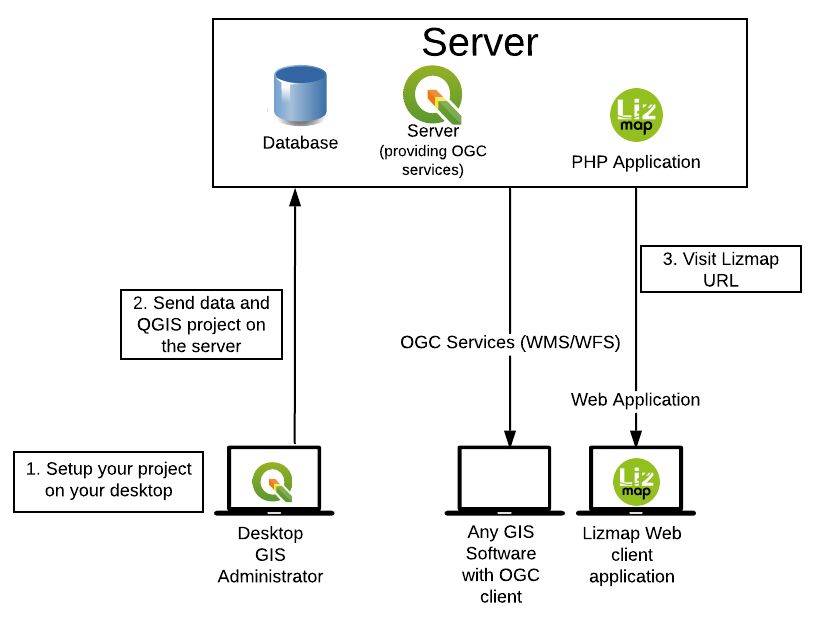
Preparación de datos
La creación del mapa se realiza en su propio ordenador con QGISDesktop:
cargando capas,
creación del mapa,
organizando y preparando los datos.
Configuración & publicación del mapa
Para poder publicar el mapa en la red, el editor configura las opciones de publicación (escalas, capas base, metadatos) con Lizmap plugin en QGIS Desktop. De este modo se sincronizan sus carpetas de trabajo con su servidor en intra-o extranet.
Visualización de datos
Cuando la sincronización es completa, se puede acceder al mapa de QGIS enInternet simultaneamente. Está disponible en la aplicación Lizmap Web Client con un navegador web (Firefox, Safari, Chrome, Internet Explorer).
For more information on versions (Web-browsers, QGIS Server, PostgreSQL etc) which are supported, it’s written on the Lizmap Web Client wiki page.
QGIS y Servidor QGIS
QGIS, un completo SIG Desktop software
Gestión de un amplio abanico de formatos de datos tanto de rasters (GeoTIFF, ASC, NetCDF, etc.) como de datos vectoriales (SHP, TAB, MIF/MID, GML, GeoJSON, etc)
Gestión de bases de datos geográficas clave (PostgreSQL/PostGIS, Oracle, MSSQL, etc.)
Gestión de capas raster y vectoriales, simbología, impresión, procesamiento
Rendimiento y beneficios funcionales de un SIG desktop Software
Estandarización geográfica de los servicios web
Open Geospatial Consortium, OGC, consorcio para la estandarización del intercambio de información geográfica a través de Internet
Web Mapping Service, WMS: estándar para publicar mapas como imágenes
Web Feature Service, WFS: estándar para publicar datos geográficos vectoriales
Web Coverage Service, WCS: estándar para publicar datos geográficos formato raster
El Servidor QGIS te permite publicar fácilmente 3 tipos de Servicios Web Geográficos estandarizados:
Instala el Servidor QGIS en un servidor
Configura las propiedades de los Servicios Web Geográficos
Copia y pega los proyectos QGIS y los archivos de datos
El Servidor QGIS y QGIS Desktop comparten el mismo motor de renderizado
Características de Lizmap
Open Source
Lizmap and the modules are opensource projects edited and managed by https://3liz.com
The source code is currently available on https://github.com/3liz/ Help is available through :
Github tickets
Our mailing-list : https://lists.osgeo.org/pipermail/lizmap/
On IRC on the #lizmap channel of https://libera.chat
Commercial support through 3Liz, contact mailto:info@3liz.com?subject=CommercialSupportRequest
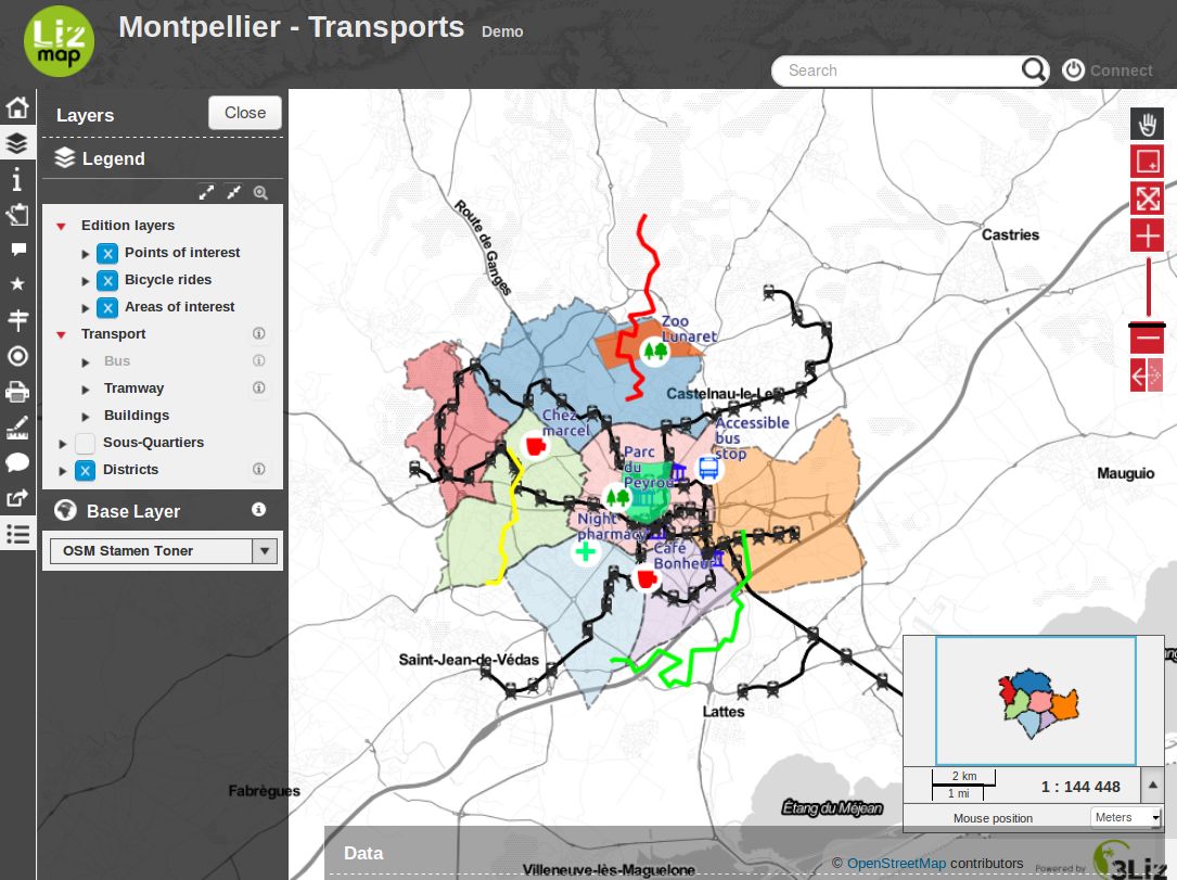
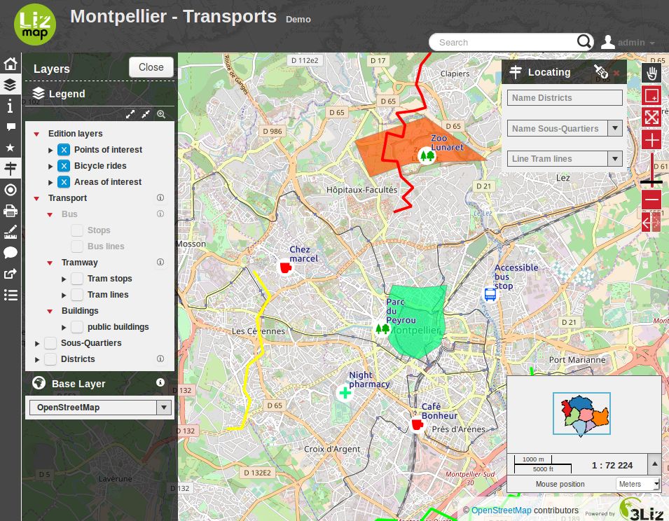
Características principales
Por defecto, Lizmap ofrece mapas web con las siguientes características:
pan
zum a un area definida por el usuario
Más zum
selecciona un nivel de zum con una barra de nivel
Menos zum
mustra la escala como barra de escala y escala numérica
La leyenda representada conserva el orden y organización definida en QGIS.
The interface allows the user to hide the legend and take advantage of the map in the entire width of the screen. It also lets you view the information on the map (description, extent, contact).
Finally Lizmap is a proxy to the web services used to construct maps. It is therefore possible to use WMS or WFS requests through Lizmap. It is possible to secure access to web services for access in QGIS or ArcGIS. It is also possible to share these addresses with web services systems cataloging.
Additional Lizmap modules
Some modules can be added to Lizmap :
- AltiProfil
Display a profil with altitude according to a line and a DEM (Digital Elevation Model)
- Map builder
To combine many Lizmap projects into a single map viewer
- PgMetadata
For displaying metadata stored with the QGIS PgMetadata plugin. It is also providing a DCAT XML catalog, to be harvested by external services
- PgRouting
For displaying itinerary between two points using the PgRouting extension for PostGIS.
- Web Processing Service
To execute QGIS Processing algorithms or models on a server and view the results within Lizmap
Specific to France use-case :
- French adresse
For managing addresses
- French cadastre
For managing cadastre data
- Naturaliz
For managing species and observation data
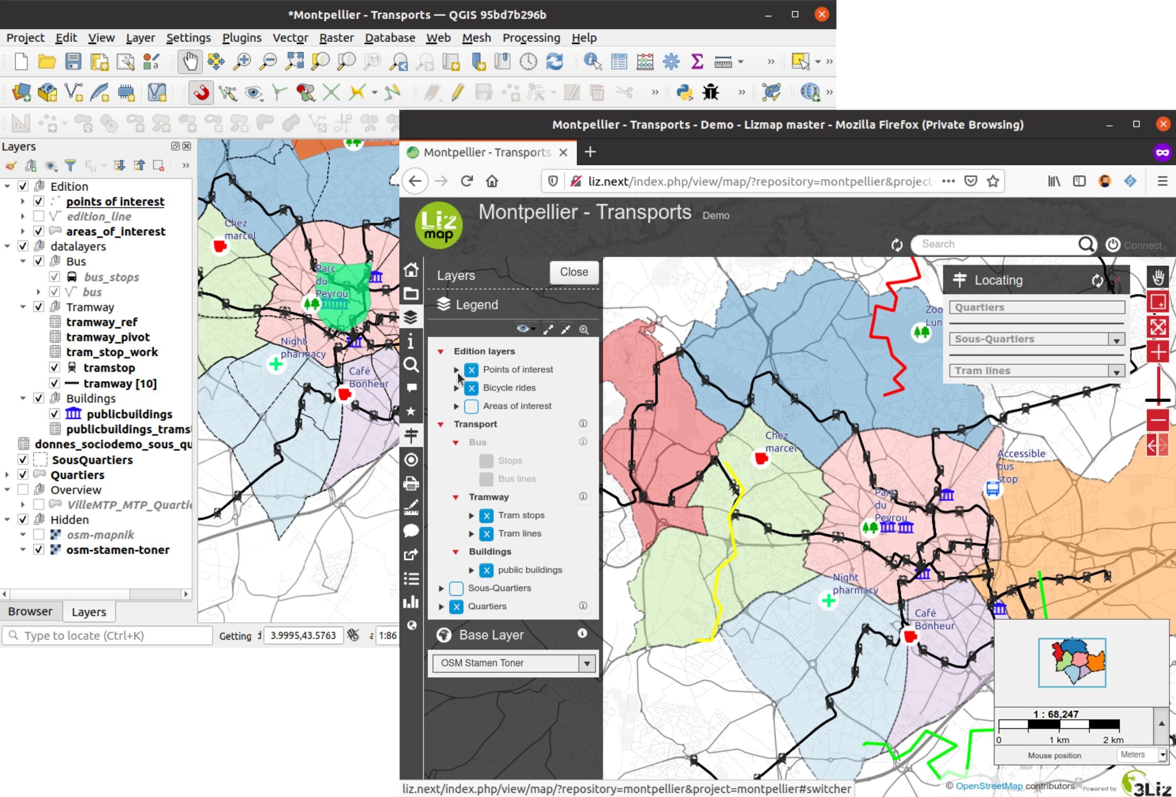
Configuración con QGIS
La configuración del mapa se hace en QGIS.
One part comes directly from the QGIS project:
legend order and structure
simbología de la capa
location map with a group Overview in the legend
configure print templates via composers
The rest is done with the Lizmap plugin. This plugin allows to:
specify the layers and groups name in the Web interface
group the layers into a single WMS layer
set some layers as baselayer
set the display layer system: alone image or tiles
set the lifetime of the images in the cache
set the lifetime of the images in the network
set the popups for querying layer
set a link to the metadata
set the map scales
set the tools available with the map:
printing
measuring length, area and perimeter
using user geolocation (GPS)
address search in OpenStreetMap or Google
set external baselayers:
Google Maps
Bing Maps
OpenStreetMap
Géoportail IGN
set layers for navigation shortcut:
search in a layer field
zoom to the selected item
cascaded search within 2 fields of the same layer or between joined layers
Configuring with the Web back-office
The Lizmap back-office defines:
the directory list containing maps
users” rights by map directory
using subdomain to improve the responsiveness of the interface.
In a nutshell
HTML5 interface compatible mobiles and tablets
Grouping maps by directory: application multi-directories and multi-projects
Management of access rights per directory for user groups
Automatic map cache management
Multilingual interface: English, French, Italian, Spanish, Portuguese, Greek
Using external baselayers: OSM, Google, Bing
Impresión
Online edition: adding, spatial and filed changing, deleting
Zoom with localisation
Address search: Nominatim (OpenStreetMap engine), Google
Access logs
Requirements
Version of Lizmap Web Client requires:
Firefox ≥ 63
Edge ≥ 79
Chromium ≥ 54